Dhaka, Apr 27 (Just News): Concerns over what the annual rainy season in this part of the world, the southwest monsoon, may hold for the multitudes of Rohingya refugees who started streaming across the international border from Myanmar last August mainly into three upazilas of border district Cox's Bazar, have been voiced from the start of the influx.
The sheer scale of the influx, the pattern that developed in settling them, and a sense of alarm raised by flashfloods and mud-or-hill-slides in the same areas during last year's monsoon, which caused some of the most disastrous and fatal incidents in living memory, all served to reinforce them.
The scale of the influx was recognized quite early on by international bodies like the UN as the fastest-growing refugee crisis they had dealt with since the Rwandan genocide in 1994.
On September 15, just three weeks after the first movement of people fleeing a crackdown by the Myanmar army was reported on August 25, the UN's refugee agency UNHCR reported a whopping 380,000 Rohingya had entered Bangladesh. After 5 weeks, this had swelled to 512,000 -maintaining the rate of over 100,000 per week.
Thereafter the momentum eased somewhat. The Inter Sectoral Coordination Group, a cluster of groups working in the area convened by the UN's migration agency IOM, in their last update of 2017 reported 655,000 refugees entrants since August 25, including 628 in the week preceding the report.
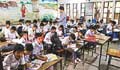
Now it is commonly estimated that some 700,000 Rohingya entered Bangladesh as part of the influx - pushing the overall Rohingya refugee population in Bangladesh to 1.1 million.
It is important to consider the numbers in the context of the 1.1-1.3 million that was estimated to have been the size of the entire Rohingya population in Myanmar prior to 2015.
Coming to the pattern, it was the cutting down of hills and trees in the name of building safe settlements for the persecuted Rohingya, that bothered most observers familiar with the region's problems, seeing that those are the two acts most likely to exacerbate the dangers of landslides.
Initially 5,500 acres of forest land was allotted for the Rohingyas to shelter in Ukhia and Teknaf, although locals say eventually over 6,000 acres of forest land owned by Cox's Bazar South Forest Department was destroyed.
This in turn has caused some locals in the areas to express deep concern over the incessant hill cutting in the last few weeks. According to them, two hills are being cut down per day for the purpose of housing the hapless Rohingyas.
Yet it would seem not enough thought was given to their safety in the new makeshift settlements, especially if the crisis prolonged itself - as it did.
Talking to UNB, Rohingya Refugee Repatriation Commissioner Abul Kalam said that around 150,000 people in the camps are in danger from landslides, floods and other natural disasters during the upcoming monsoon.
Losing their humanity
Advocate Ayasur Rahman, president of Save Cox's Bazar movement, said it is common knowledge that cutting hills to build homes can never be safe.
"The forests are being razed in the name of safe settlements which are actually a threat to human life and in the process wildlife too," Advocate Rahman said. Professor M A Anwarul Haque, advisor to the Cox's Bazar Forest and Environment Conservation Council, believes sheltering Rohingyas by cutting down hills was a wrong decision as their lives are now at risk.
"It was necessary to fix a shelter for the Rohingya people in consultation with the Department of Forest and Environment, and environmentalists," said Prof Haque.
A loss of goodwill can increasingly be sensed among the local population towards the Rohingya refugees, who are now less seen as helpless folk fleeing persecution and more as competitors for scarce economic resources.
Tree-cutting in the area has increased exponentially, in the wake of the refugee crisis. This wasn't just to make room for the Rohingya refugee camps - trees continue to be cut by the refugees for use as firewood, for example.
The increased dangers of landslides caused by their presence thus draws the ire of the locals even more. The horror of the fatal landslides that occurred in 5 adjoining districts including Cox's Bazar last year are still fresh. The district has a history of landslides, with over 300 deaths caused by them over the last decade.
Even so, nothing had prepared people for the events of last June, when torrential monsoon rains triggered a series of landslides and flash floods in Rangamati, Chittagong, Cox's Bazar, Khagrachari and Bandarban, killing at least 152 people (estimates reach as high as 168).
Further such incidents with fatalities kept occurring over the remaining monsoon months in 2017, although their scale was nowhere near the June disaster, which according to officers at the Disaster Management Department, were the worst landslides in the country's history. Even then, extensive deforestation in the area was held up as a reason for it.
And that was all before a single hill or tree had been cut down by or for any Rohingya.
(Justnews/ys/1025hr)