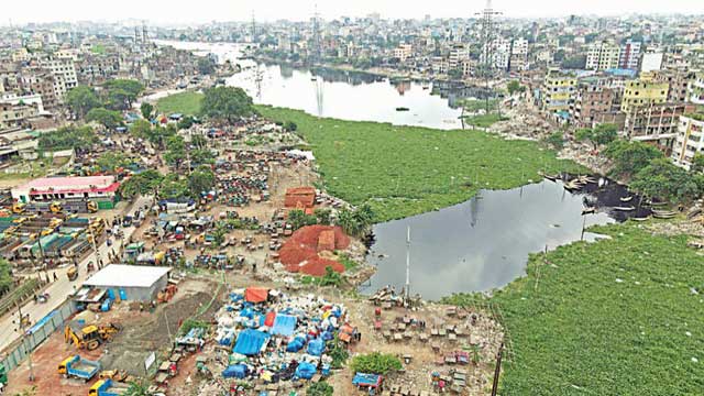
The cadastral survey records of some areas in the capital have been damaged over the years resulting in the encroachment on river lands and problems in demarcating river boundaries following the High Court orders.
Some Record of Rights and maps prepared following the cadastral survey undertaken between 1888 and 1940 were found damaged in the record room after making countless reproductions for almost over 100 years, Dhaka district additional deputy commissioner (revenue) Md Elias Mehedi said.
He said that the district administration did not collect CS records later as the Survey Act, 1875 had stipulated to follow the latest survey and the latest one for the capital was the City Survey, which had been notified in the government gazette in 2010.
‘Which is why we could not provide Record of Rights of some moujas to the River Conservation Commission which asked for the records for demarcating the boundaries of the Buriganga following the High Court Division order,’ Elias said.
The High Court in 2009 and subsequent years, however, ordered that the cadastral survey should be followed to demarcate boundaries of rivers, he said.
‘An inter-departmental meeting is required to solve the problem,’ he added.
The commission’s river survey project director Ikramul Haque, however, said that the commission was facing difficulties in completing a digital survey of the River Buriganga for not getting Record of Rights and maps following the CS despite sending a request to the Dhaka district administration and the Land Record and Survey Department on several occasions in the past six months.
Ikramul said that the commission asked for documents of 13 dags of Mirpur mouja, Ramchandrapur mouja, Katasur mouja, Shahar Dhaka mouja (sadarghat area) and Kotwali mouja after the Space Research and Remote Sensing Organisation while conducting the digital survey on behalf of the commission identified disputes over lands in those areas.
‘SPARRSO researchers asked for those documents to come to concrete decisions whether those disputed lands that they identified through satellite image analysis belong to the river, canal or they are private properties,’ Ikram said.
SPARRSO researchers, he said, identified the disputes analysing satellite images of the river of 1972, 2010 and 2019, and also aerial photos of 1983 and 1984.
Admitting that the issue was a major problem, land secretary Md Mustafizur Rahman said that the land ministry would do everything required to resolve it.
SPARRSO was commissioned in 2019 for developing a digital map of the river according to its authentic demarcation lines after taking into account the fluctuation of course of the river and its present deviations from the cadastral survey conducted 100 years ago.
Bangladesh Inland Water Transport Authority officials and environmentalists said that most of the grabbers of the Buriganga belong to these five moujas and most of them who grabbed the old channel of the Buriganga could not be evicted despite drives conducted from 2019 to 2021.
They said that the old channel of the Buriganga flows mostly through these five moujas and the corrupt officials of the survey department and Dhaka DC offices helped the grabbers by producing Record of Rights during the city survey notified in the government gazette in 2010.
‘Over 2800 acres of khas land of the capital are shown as private properties in the city survey by corrupt survey department officials,’ said advocate Manzil Murshid.
A High Court bench in 2018 ordered the government to conduct a fresh city survey and punish the officials behind the corruption, he said.
Department of Land Records and Surveys director general Md Taslimul Islam said that the department was reinvestigating whether 2,800 acres of khas land had been shown as private property during the city survey.
He further claimed that the department had handed over all documents to the DC office and anybody or any agency that required such documents should collect those from the DC office.
‘We can only supply maps charging a fixed rate and the river commission will also have to follow the process,’ he said.
Bangladesh Environmental Lawyers Association executive director Syeda Rizwana Hassan, however, smells a rat in such damage of documents of the disputed properties and the disappearance of 2,800 khas land during the latest survey.
‘This brings to light the height of inefficacy, if not corruption. The custodians of these valuable resources need to face the music to avoid such incidents in future,’ she said, adding that the river commission must get hold of all land records from all over Bangladesh without any further delay.
River commission PD Ikram said that the SPARRSO was conducting a similar digital survey of the Shitalakkhya, the Turag, the Balu and the Dhaleswari.
Under its Tk 30.57 crore project, Ikram said that the commission would produce field assessments of grabbing, navigation, pollution, erosion of 48 rivers.
‘We have already completed field visits of 30 rivers and produced 24 reports,’ he claimed.
Md Taslimul Islam said that the land ministry started digitising all records to solve the problem.


